On QGIS
All the old maps in the COVADEO catalog can be downloaded. However, you can also view them directly in QGIS. Please refer to the following tutorial to do this. This catalog is made available via the STAC standard.
Before you begin
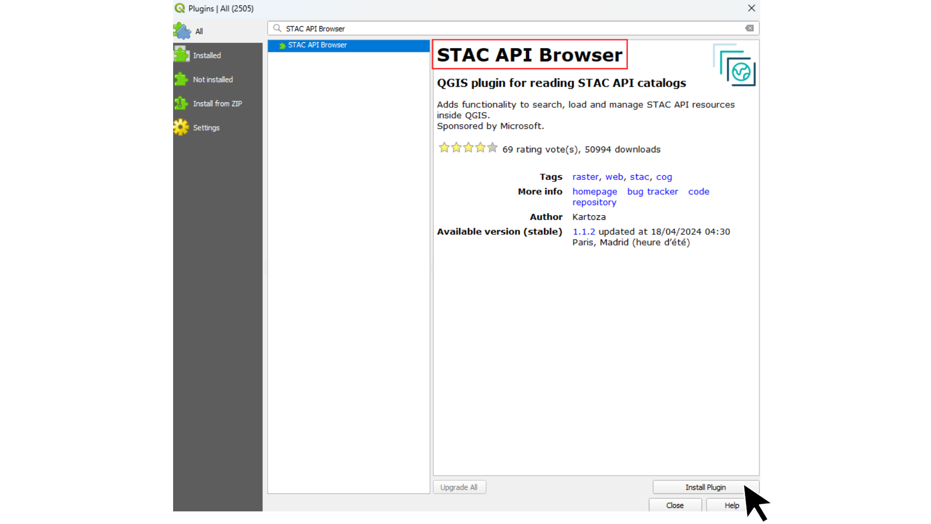
In order to view our catalog in QGIS, you must be using version 4.0 or later. If so, proceed to step 2. Otherwise, either install a more recent version of QGIS or start with step 1, which explains how to install the STAC API Browser extension.
If not, go to the 'Extensions' menu and select 'Install/Manage Extensions'. In the 'All' tab, search for the extension and click 'Install'.
Go to Layers > Data Source Manager in the menu. In the window that opens, click on the 'STAC' tab.
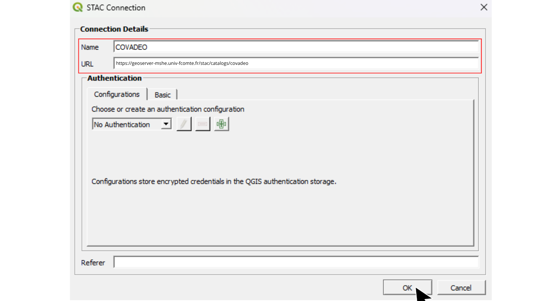
Click 'New'. In the dialogue box, give the connection a name of your choice, then enter the following URL: https://geoserver-mshe.univ-fcomte.fr/stac/catalogs/covadeo.
Finally, click OK to confirm.
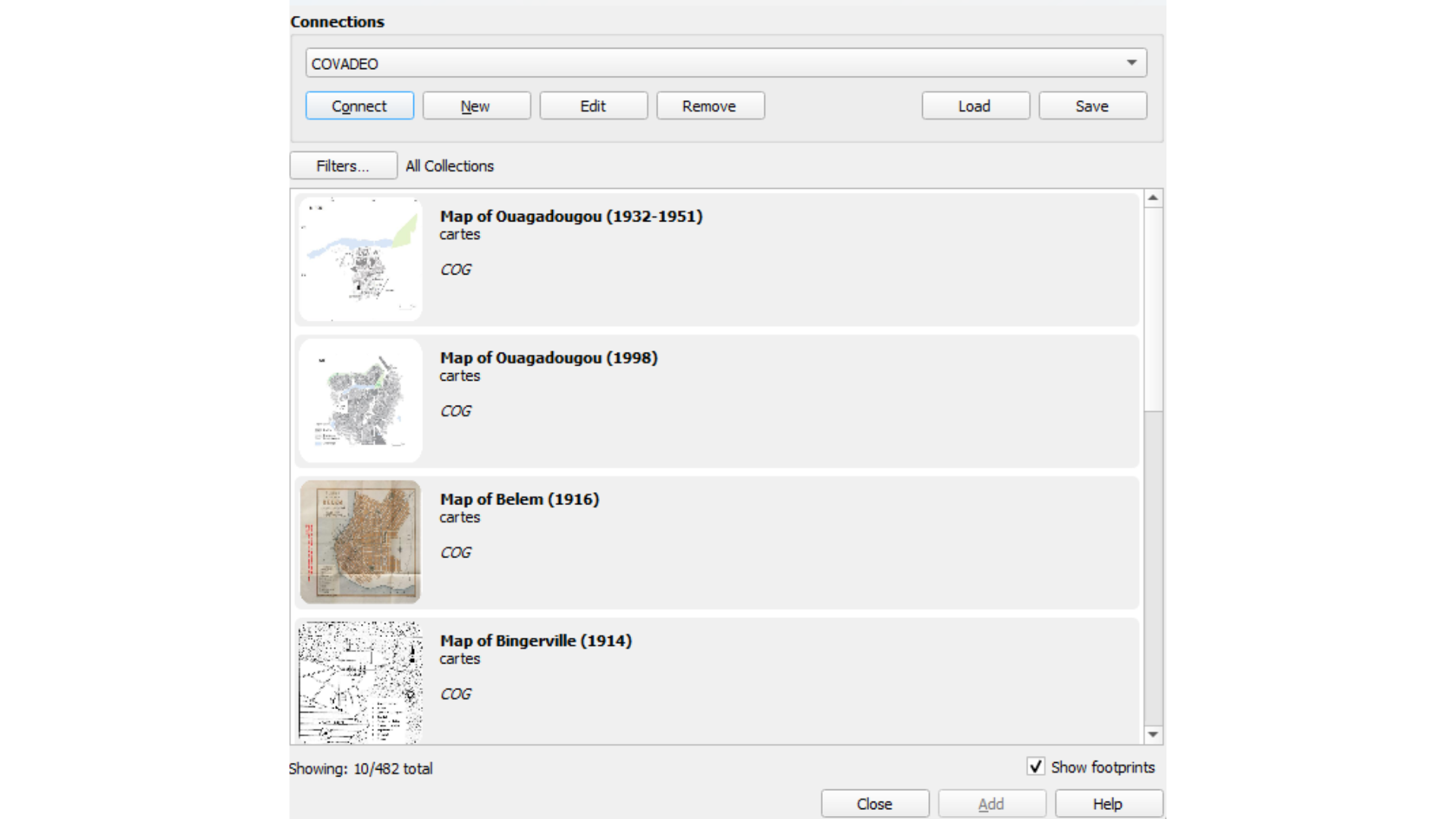
The catalog data is now connected. To access it, click on 'Connect'.
Well done! You now have access to the full COVADEO catalog. Here are a few tips to help you get started with the tool:
- View metadata: Double-click on the map thumbnail of your choice.
- Add a map to your QGIS project: Click on a map (its thumbnail will turn blue), then click the 'Add' button.
- Show or hide the footprint (georeferencing polygon): Check or uncheck the 'Show footprints' box.