Frequently Asked Questions
 How can I contribute?
There are two ways in which you can contribute:
- Add a map to the catalog.
- Playing the COVADEO serious game, in which you must reconstruct the past roads using old maps.
How can I compare two maps?
Follow these steps to compare two maps:
-
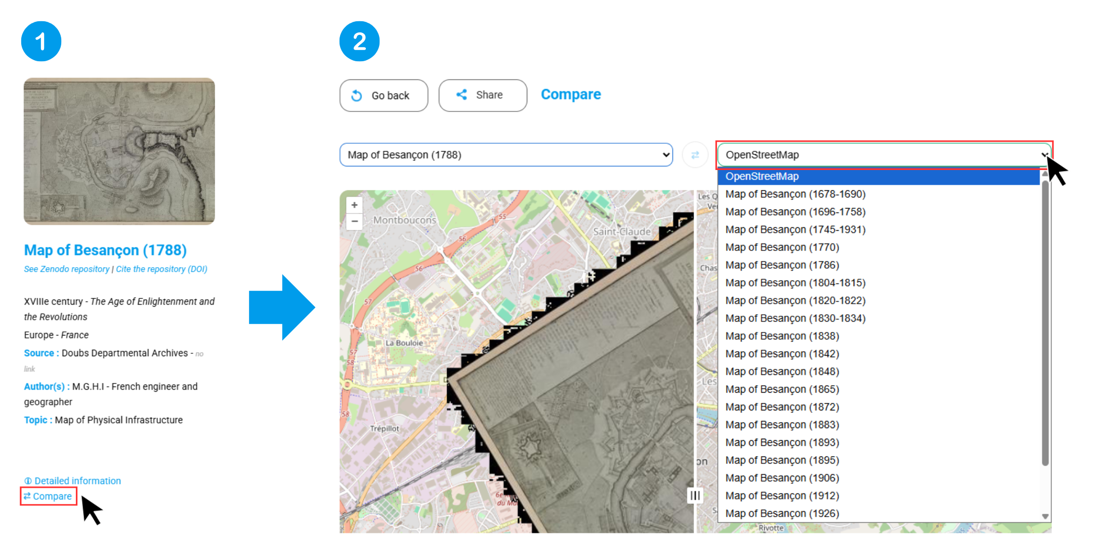
Select the first map from the list page and click the "Compare" button. You will then be automatically redirected to the comparison interface.
-
Choose the second map to compare with the first. Note: You can only select a map that overlaps the first one geographically. You also have the option to compare the selected map with the OpenStreetMap base map.
How can I view and download the metadata for a map?
To view and download a map's metadata, follow these steps:
-
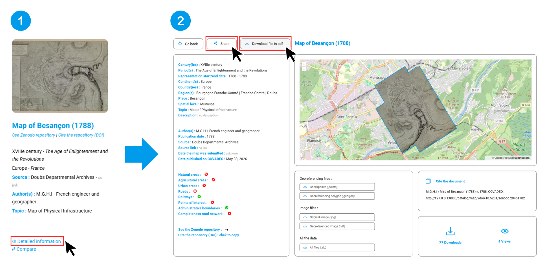
Go to the list page and click the "Detailed Information" button or the image. You will then be redirected to a page displaying all the data for the selected map.
-
At the top of this page, there are two options:
- Share the link: You can either copy the link to the metadata page or send it directly via email.
- Download as a PDF: This will export the map’s metadata sheet (which also includes a link to the online page).
How can I download the data associated with the maps? (.points | .geojson | .jpg | .tiff)
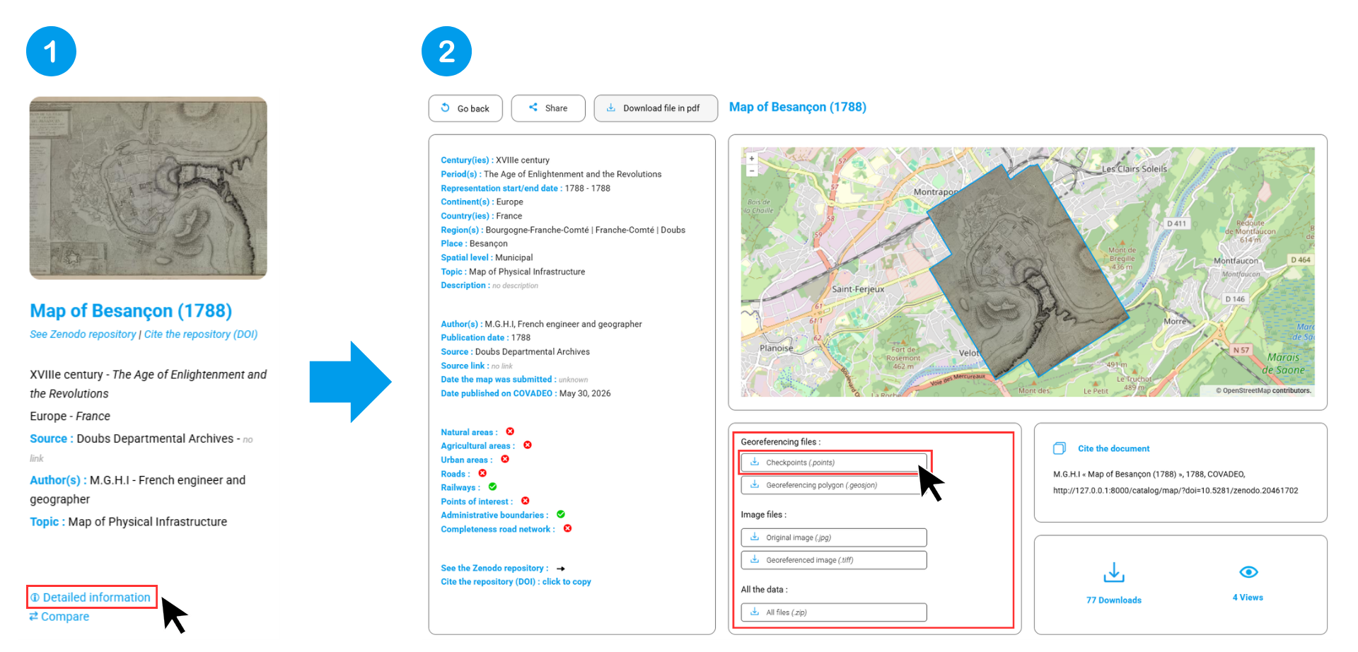
To download the data associated with a map, go to the list page and click "Detailed Information" or the image. You will then be automatically redirected to the correct page. At the bottom of this page, you will find a section dedicated to downloadingthe various files associated with the map.
How can I filter the data?
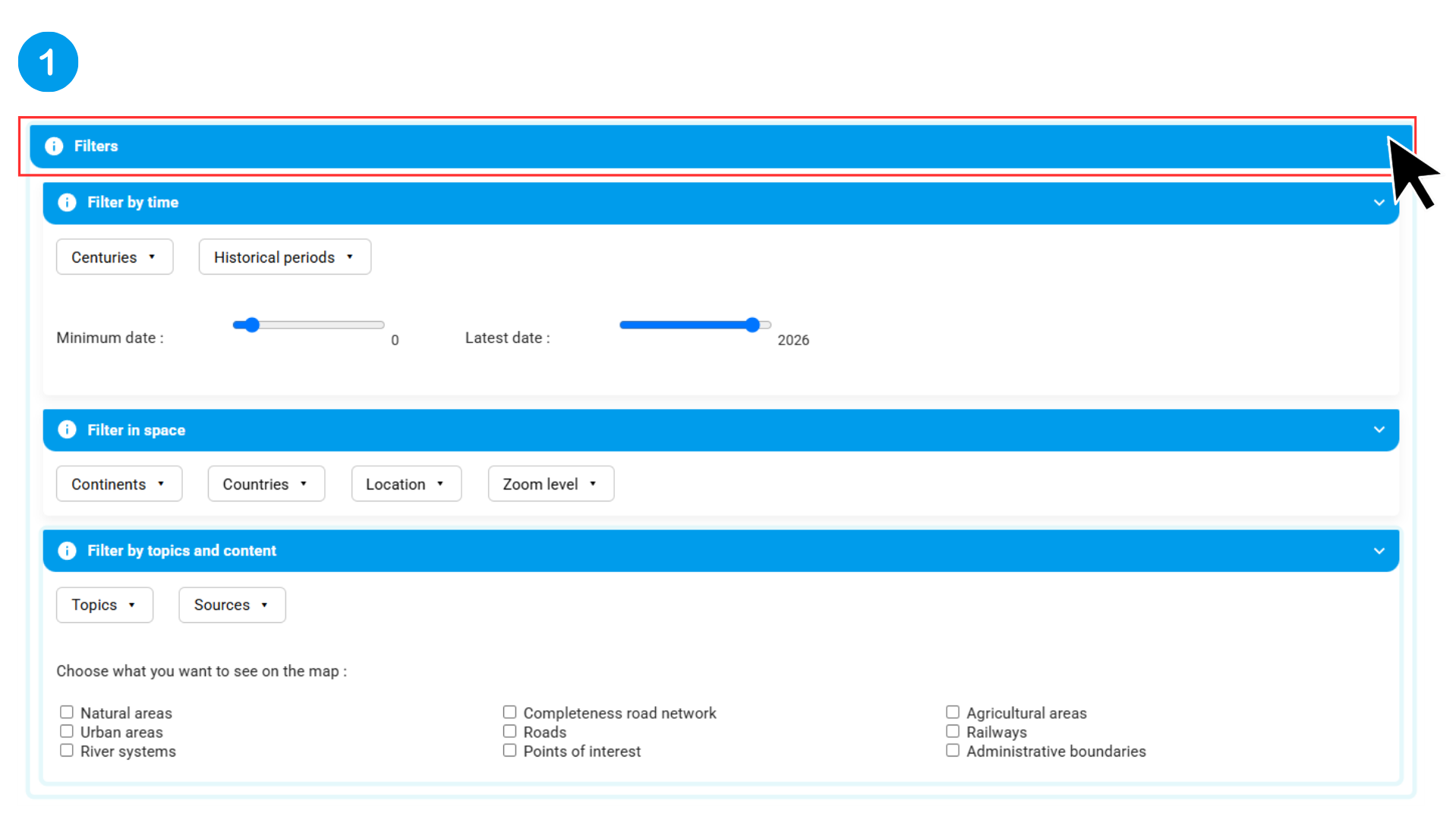
You can filter the data using three different tools:
- The map list
- The map portal
- The timeline
All three pages use the same filters. They are organized into three categories:
- By time
- By space
- By topic and content
The maps displayed after applying one or more filters are those that meet all the currently applied filters. To reset the filters, click the "Reset" button. The number of maps displayed (with or without filters applied) is shown next to the Reset button. To save a filter configuration, copy the page's URL (so you can return to it later without losing the filters applied).
Where is the data stored?
The metadata for these maps is stored in a database at the ThéMA research center, while the large data files (image files, georeferenced data, etc.) are hosted on the Zenodo European repository. The two databases are linked via the Digital Object Identifier (DOI), which is a unique identifier assigned to each map by Zenodo.
Where do the maps come from?
The maps in the catalog come from various sources, such as departmental archives, municipal libraries, or Gallica (the National Library of France). While the first documents were added by the COVADEO project administrators, the catalog is now collaborative: anyone can submit a map, whether it comes from municipal or departmental archives, or even from personal or family collections.
To help expand the catalog and add a map, please follow the detailed steps on the next page.
How can I contact the project team?
If you wish to contact the project team, please send an email to the following address: covadeo@umlp.fr. However, before you do so, we encourage you to visit the following page, where you will find all the necessary instructions.
How can I search the catalog?
There are two ways to search the catalog:
- From the home page, where you will then be redirected to the results page.
- Or directly from the list page.
Tips for optimising your searches:
- Simplified search: The search engine is flexible and ignores special characters (accents, cedillas, etc.). For example, typing “Besançon” or “Besancon” will yield the same result.
- Multi-criteria search: You can combine multiple keywords using the "and" separator. Example: Searching for 'Besançon and 1878' will display only maps of Besançon from 1878.
Where can I find the maps that have been added most recently?
To view the maps that have been added recently, go to the "Catalog" tab. Only the last four maps added are displayed.
How can statistics be used to compare two areas?
To compare two ares, go to the "Statistics" tab and select "Compare Territories". You can then compare either:
- Countries
- Places
Use the selectors to choose "Territory 1", then "Territory 2".
