
This one-day workshop is dedicated to the analysis of documents of territorial planning. It will give the opportunity to analyse planning politics at several scales. Participants will explore several interpretative frameworks that were previously applied to different types of planning documents. Participants will also think about benefits and limits of qualitative and quantitative approaches.
In the morning, a round-table discussion will enable researchers to share their methodologies to analyse planning documents: local urban design plans, local mobility plans, regional schemes...
- Details
- Category: Diffusion

Yohan Sahraoui will defend his accreditation to supervise research entitled: Hybrid landscapes. A critical and participatory modelling. The defence will take place on the 9th of January 2025 at University Paris 1 Panthéon Sorbonne, Centre Panthéon, 12 Place du Panthéon, 75231 Paris.
The jury comprises:
Xavier Arnauld de Sartre, Research director CNRS – Recorder
Thierry Joliveau, Emeritus professor, University Jean Monnet Saint-Etienne – Examiner
Yves-François Le Lay, Professor, Ecole Normale Supérieure de Lyon – Recorder
Nathalie Long, Research director CNRS –...
- Details
- Category: Dissertation Defence
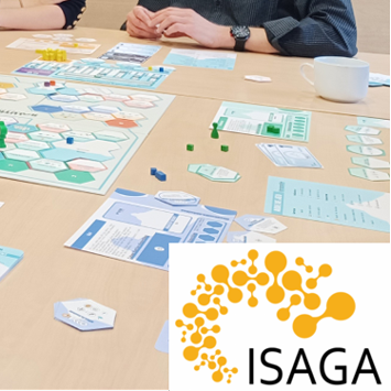
The award has been attributed by the International Simulation and Gaming Association in October 12-13 2024. For the award president Paola Rizzi (DICEEA, Université of Aquila, and DADU University of Sassari, Italy) and her colleague Heide Lukosch (University of Canterbury, New Zealand) Solutré is “the “more accomplished game for urban and regional planning”.
All details about the award are available at: https://isaga.com/our-activities/isaga-simulation-and-gaming-competition-isgc/
The serious game Solutré is available on the web site of the Presses universitaires de Franche-Comté...
- Details
- Category: Award and distinction
After a Ph.D. in population biology and ecology in the ThéMA laboratory (2017-2021), Paul Savary has been a post-doctoral fellow in the Department of Biology of Concordia University in Montreal (Canada) from 2022 to 2024, under two different fellowships.
He is starting a new position as an Assistant professor (Chaire de Professeur Junior) in ecology and spatial modelling at ThéMA. His research mainly focuses on species movements within spatial ecological networks. Lately, he has been using citizen science data to investigate biodiversity dynamics within urban ecosystems, a research...
- Details
- Category: Diffusion

Louis Kalisky is taken on at ThéMA for seven months in the frame of the research project « rétroplanning » supervised by Thomas Buhler. Louis has received a master degree ADAUR in 2024 at the University of Franche-Comté.
Hugo Dalle also holds a master degree ADAUR. He is taken on for eight months in the frame of the research project FOREST’ADN funded by the regional council Bourgogne Franche-Comté and the Graduate School Transbio (research laboratories ThéMA and Chrono-Environnement). Hugo will map and identify forest cover that...
- Details
- Category: Diffusion

Melissa Poupelin is defending her thesis named : "Geoprospective and climate modelling of urban vegetation in a perspective of adaptation to heat waves: Dijon Métropole as a study case."
This work was conducted under the supervision of Thomas Thévenin and Yves Richard, with the guidance of Julien Pergaud, within the ThéMA laboratory (UMR CNRS 6049, UFC-uB) and the research team at the Climate Research Center of the Biogeosciences laboratory (UMR CNRS 6282, uB) in Dijon.
The defense will take place publicly on Monday, December 16th, at 2:00 PM, in the amphitheater of the Maison des...
- Details
- Category: Dissertation Defence
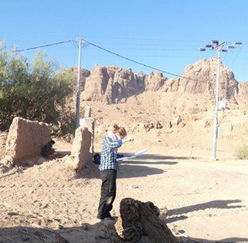
Julie Gravier studies long-term settlement dynamics. Two questions drive her research: why and how do settlement systems persist in the same places for extremely long periods of time? What is the political role of individuals and groups in perpetuating the social functioning and spatial organization of settlement systems? Her aim is to understand the ways in which societies inhabit the world, taking into account very long-term dynamics and the temporal shifts in certain decisions on other processes. To achieve this, she studies a wide range of chronological and cultural cases, mainly on...
- Details
- Category: Diffusion
The thesis prize 2024 of the French Complex Systems Society (CSS/France) awarded six young doctors among eighteen finalists. It was attributed during a colloquium organized by the École Normale Supérieure of Lyon, the 19-20th of September 2024.
Hanae El Gouj’s thesis has also been selected by the French National University Council to compete for the thesis prize of the Comité National Français de Géographie (CNFG), which will be attributed during the International Geography Festival in October 2024.
Hanae El Gouj’s thesis, entitled “Analysis, modeling and simulation of road network...
- Details
- Category: Award and distinction
The book was published in July 2024 by Wiley-ISTE.
The aim of this book is to provide an overview of the concepts and methods used in fractal analysis and modeling in order to study the spatial distribution of human settlements. The main concepts and mathematical tools are reviewed, and emphasis is placed on the practical benefits of their application and the pitfalls to be avoided when using them.
The first part of the book is devoted to the basic concepts and geometric reference figures required for fractal analysis in human geography. In the second part, the principles of four...
- Details
- Category: Publication and Output
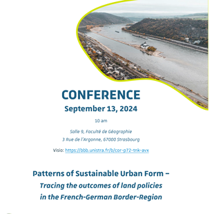
Manon Kohler organizes this workshop with two invited speakers: Mathias Jehling and Casper Kleiner from the Leibniz Institute of Ecological Urban and Regional Development (Dresden, Germany).
The workshop will take place at 10:00 am in the Geography Department of Strasbourg.
Broadcasting: https://bbb.unistra.fr/b/cor-p72-tnk-avx
Mathias Jehling is senior researcher at Leibniz Institute of Ecological Urban and Regional Development (IOER) in Dresden, Germany, where he leads the research group on “Urban Structure and Policy”. His focus is on geographic information in the planning context....
- Details
- Category: Diffusion